 Index
Index

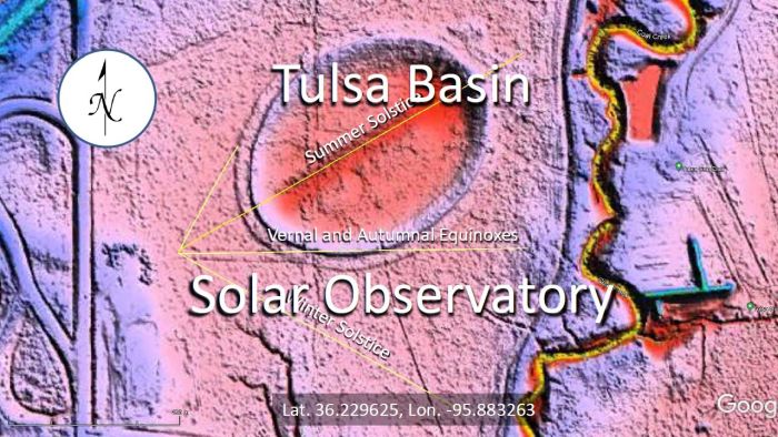
An elliptical basin found using LiDAR images near the Oxley Nature Center in Tulsa, Oklahoma has led to a surprising archaeological discovery. The lines carved on the west side of the Tulsa Basin are aligned with the sunrise during the solstices and the equinoxes. The Tulsa Basin is probably the best ancient solar observatory in the United States.

This LiDAR image shows the elliptical basin to the northeast of Tulsa, Oklahoma.

the Tulsa Basin has the same origin as the Carolina Bays because 1) it has an elliptical geometry characteristic of inclined conical cavities, 2) it has raised rims typical of impact cratering and 3) its major axis is oriented toward the Great Lakes. These three features are consistent with the Glacier Ice Impact Hypothesis published in Zamora, 2017.
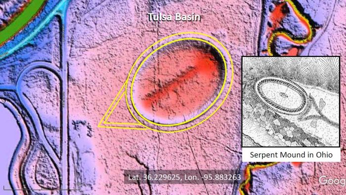
The Tulsa Basin is perfectly elliptical. This is typical of well preserved Carolina Bays. A well-formed berm approximately 15 meters wide surrounds the elliptical basin. This berm could only have been sculpted by humans. Typical Carolina Bays have a broader rim at the distal end of the ellipse created by the forward momentum of the projectile, but the Carolina Bay rims are not regular like the Tulsa Basin. Parallel lines approximately 11 meters apart are carved on the ground to the west of the Tulsa Basin and converge at a 60 degree angle. The Serpent Mound in Ohio has similar features, but it is oriented toward the setting sun on the summer solstice. This occurs on the 21st day of June when the sun reaches its northernmost point on the horizon and it is the longest day of the year.

The point of the converging lines is not aligned with the major axis of the basin.

The Solar Calculator of the National Oceanic and Atmospheric Administration can be used to find the azimuth of sunrise for the Tulsa Basin on June 21st. A line bisecting the angle carved on the ground is aligned with the summer solstice on June 21st at sunrise (06:08 AM) with an azimuth of 59.97 degrees.
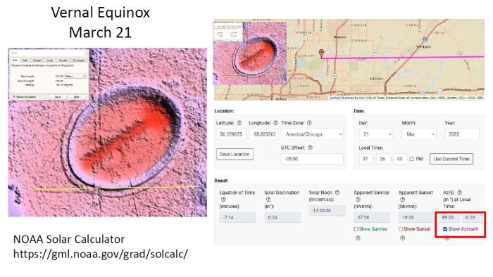
The lines carved on the ground in an east-west direction are aligned with the vernal equinox on March 21st at sunrise (7:26 AM) with an azimuth of 89.03 degrees.
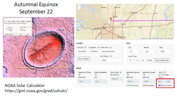
These same lines in an east-west direction are aligned with the autumnal equinox on September 22nd at sunrise (7:12 AM) with an azimuth of 89.2 degrees.
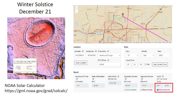
The NOAA solar calculator shows that the sunrise during the winter solstice has a heading of 119 degrees. However, the LiDAR image does not show any lines carved in the ground in that direction.

The lines aligned to the northeast with a heading of 29 degrees are perpendicular to the heading for the winter solstice. The clever people who constructed this solar observatory must have used an instrument like a carpenter's square aligned with the carved northeast lines to get the heading for the winter solstice.

The lines carved on the ground to the west of the Tulsa Basin are evidence that this site was used as a solar observatory to track the seasons. Knowing the cycle of the seasons has always been very important for planning the right time for planting crops and for hunting animals during their yearly migrations.
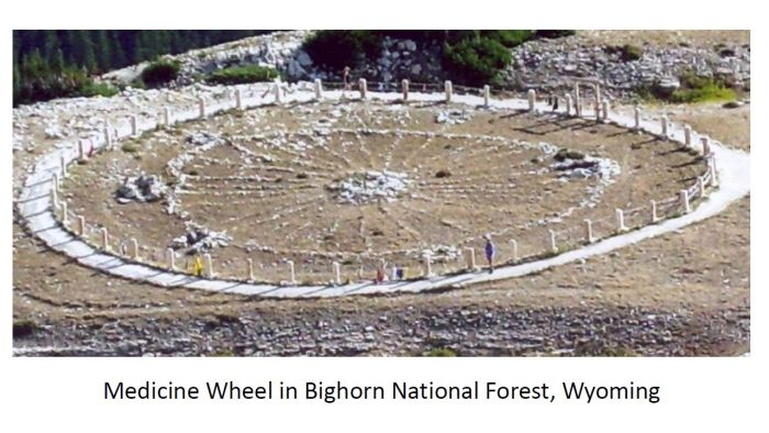
There are many examples of solar observatories in America. Some are spiral carvings on rocks and others are circular arrangements of rocks, like the Medicine Wheel in Bighorn National Forest, Wyoming, which has a diameter of 23 meters.
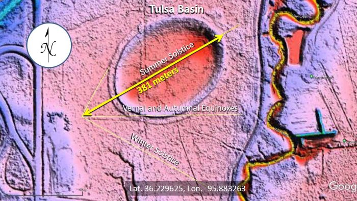
The Tulsa Basin solar observatory measures 381 meters from the vertex of the lines to the northeast rim of the ellipse. The ellipse is bigger than the Rose Bowl in Pasadena, California. Without doubt, the Tulsa Basin is one of the best examples of solar observatories in North America.
