 Index
Index

On September 4, 2010, the city of Christchurch, New Zealand was struck by an earthquake of magnitude 7.0. The earthquake's epicenter was located about 40 km west of Christchurch at a depth of about 10 kilometers beneath the surface. A series of aftershocks followed the September event.

The most destructive aftershock occurred on February 22, 2011. This aftershock had a magnitude of 6.3 with an epicenter 10 kilometers southeast of the city at a depth of 5 kilometers. Although this tremor was smaller, the epicenter was shallower and closer to the city.

The earthquake caused many injuries and 65 deaths because it occurred during lunchtime on a weekday when Christchurch was very busy. Many victims had to be rescued from collapsed buildings.
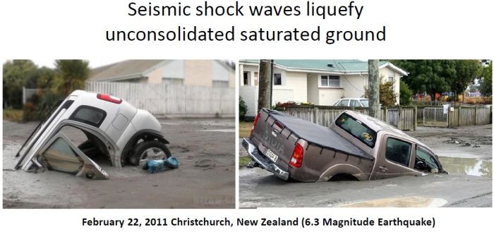
Seismic vibrations of magnitude 6.0 or higher liquefy unconsolidated saturated soil. The earthquake of February 22, 2011 in Christchurch had a magnitude of 6.3 and produced significant liquefaction that swallowed cars. Even smaller aftershocks of magnitude 5.7 caused liquefaction. Vibration of saturated soils creates quicksand that becomes solid again after the water drains away.

New Zealand lies on the notorious Ring of Fire, the line of frequent quakes and volcanic eruptions that circles the entire Pacific rim. New Zealand straddles the boundary between the Pacific and Australian plates.
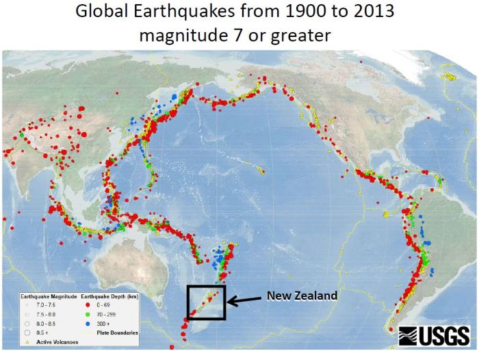
This map from the U.S. Geological Survey shows the locations of earthquakes of magnitude 7 or greater from 1900 to 2013. The boundaries of the plates of the Earth's crust, where one plate subducts under another one, are subject to frequent earthquakes and volcanic eruptions.
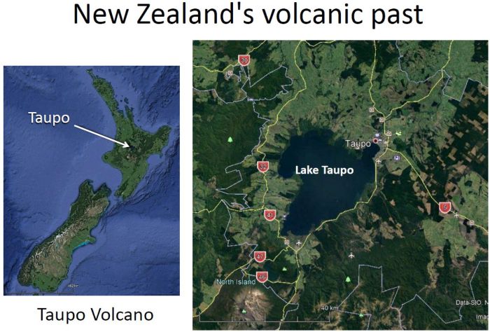
New Zealand has a long history of volcanic activity. Lake Taupo, in the center of New Zealand's North Island, is the caldera of a large supervolcano called the Taupo Volcano. This huge volcano has produced two of the world's most violent eruptions in geologically recent times. Taupo began erupting about 300,000 years ago, but the main eruptions occurred about 26,500 years ago and formed the modern caldera. Major eruptions occur approximately every thousand years.
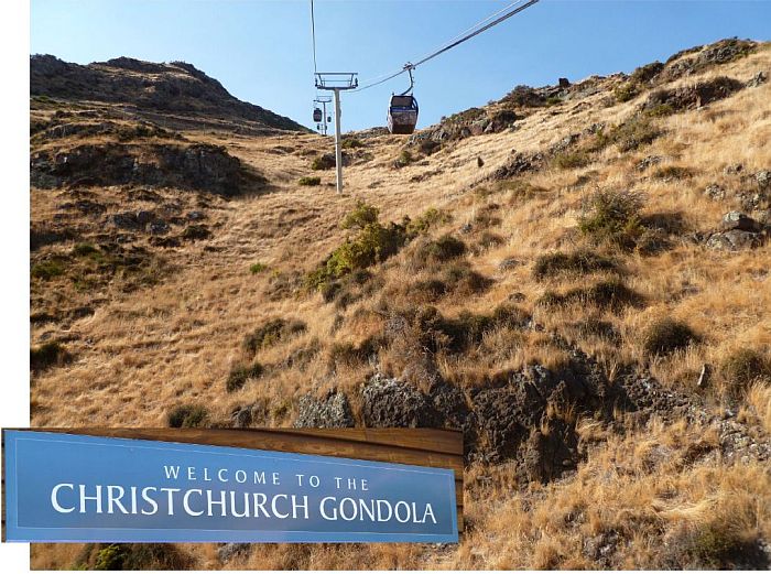
In Christchurch, a gondola built as a tourist attraction lifts you nearly a kilometer to the top of the Port Hills, which have an elevation of about 500 meters above sea level.

The observation center at the top of the hills provides a panoramic view of downtown Christchurch to the north, and the Lyttelton Harbor and Quail Island to the south.

This is a view of downtown Christchurch from the top of the Port Hills.

Quail Island is part of the crater floor of a volcano that erupted 11 to 12 million years ago.

The ground on top of the Port Hills in Christchurch is covered with small pebbles like those found at other sites of volcanic eruptions, such as Mount Vesuvius in Naples, Italy.

One of Christchurch's tourist attractions is a trolley that circles the downtown area and stops at various points of interest.
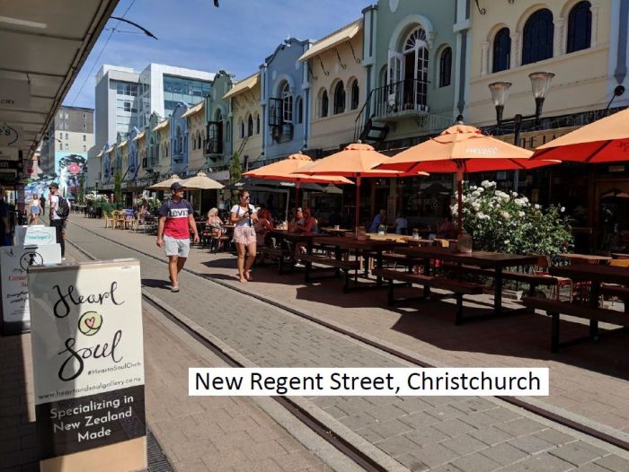
New Regent Street in downtown Christchurch has a variety of cafes, restaurants and souvenir shops that are thriving eight years after the earthquake.

Throughout the downtown area there are cranes and construction projects that are rebuilding from the ground up, but many collapsed buildings have been turned into parking lots.
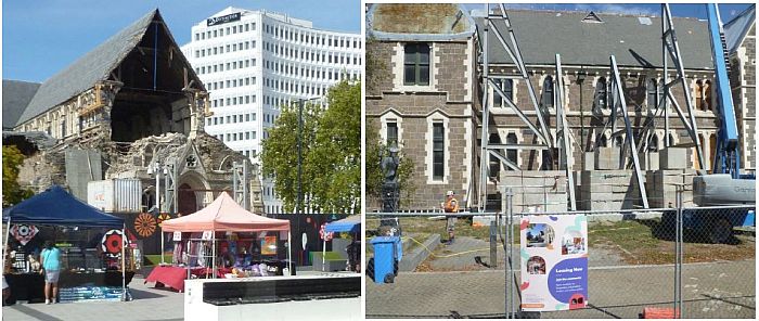
The Christchurch cathedral and the museum were heavily damaged during the February 22 earthquake. The Cathedral was built between 1864 and 1904. It has been repeatedly damaged by earthquakes. The February 2011 Christchurch earthquake destroyed the spire and part of the tower. A steel structure that had been installed to stabilize the rose window of the cathedral prior to the earthquake collapsed and destroyed the window that it was supposed to protect. The cathedral may have to be demolished.

The Christchurch Art Gallery was closed for nearly five years after the earthquake. It reopened to visitors on December 19, 2015 for exhibitions of art projects, musical performances, films, family activities, talks and tours. Christchurch is recovering, but the damage to the city is still visible eight years after the 2011 earthquake.
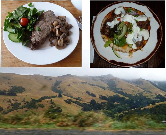
The New Zealand countryside is covered with farms where the main crop is grass for feeding cattle and sheep. Visitors certainly should enjoy the scenery and try the grass-fed beef and lamb.